The old Danube-Main-Canal
in the national park Altmuehl valley
Charlemagne was the first to realize the idea of a watercourse between Danube and Rhine via Altmuehl. He did not succeed in the long run. Some traces of his canal project are still to be seen near Treuchtlingen.
More than eight centuries later, in 1656, Frederic Wasserberg, a merchant of the Lower Rhine, suggested that the Nuremberg merchants and the Bishop of Eichstaett ![]() should build Charlemagne's canal. At that time, in the aftermath of the Thirty Years´ War, when large parts of the country were devastated, nobody was interested and nobody thought raising enough money was possible.
should build Charlemagne's canal. At that time, in the aftermath of the Thirty Years´ War, when large parts of the country were devastated, nobody was interested and nobody thought raising enough money was possible.
In the 18th century, however, the governments in France, in England and in the Netherlands built extended systems of canals, and consequently trade and traffic began to thrive in those countries. Now economists in Germany cherished the idea of the Danube-Main-Canal. In numerous periodicals Charlemagne´s idea was praised.
In the beginning of the 19th century, King Ludwig of Bavaria pondered what to do: to build a canal or to build railways. Finally he decided that both should be built.
His architect was Baron Henry von Pechmann. Pechmann carefully studied the terrain, and in 1830 he submitted his plans. He did not decide on the shortest line, but on the line which entailed less difficulties: Bamberg, Erlangen, Nuremberg, Burgthann, Neumarkt, Berching ![]() , Beilngries, Dietfurt
, Beilngries, Dietfurt ![]() , Kelheim. There was much racking of the brain as to finding the best line near Beilngries. The Ottmaring valley was swampy. The eastern slopes of Beilngries
, Kelheim. There was much racking of the brain as to finding the best line near Beilngries. The Ottmaring valley was swampy. The eastern slopes of Beilngries ![]() were covered by beer-cellars. Finally the cellars were spared.
were covered by beer-cellars. Finally the cellars were spared.
The most difficult problem was to overcome the European watershed separating the two river systems, Altmuehl and Main or Danube and Rhine respectively. From Bamberg to the watershed near Burgthann a height of 187 metres had to be overcome. From Burgthann to Kelheim ![]() the canal decends 80 metres. lt was most difficult to supply enough water at the watershed; delivery pipes from the hills were necessary.
the canal decends 80 metres. lt was most difficult to supply enough water at the watershed; delivery pipes from the hills were necessary.
One hundred lock gates had to be built; 55 lock-keepers were in charge of these lock gates. Eight harbours were built. In the years from 1834 to 1846 about 6000 workers with pickaxes, spades and shovels were busy digging the watercourse, the breadth of which was 52 feet and the depth 4.9 feet.
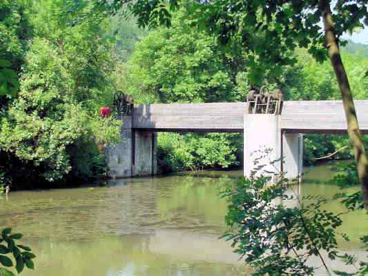
In the Second World War the canal suffered severe damages. Since the repair works would have been very expensive and the importance of inland waterways was an the decilne, authoritles decided on conveyance.
Some parts of the canal have been preserved. The old towingpaths are now nice routes for bikers ![]() .
.
back to the Homepage of the town Essing ![]()
Zuletzt aktualisiert am 10.02.2017